Bombay Beach Biennale
- Role
- Product Manager (v1 solo lead; v2 PM co-lead with Auston)
- Client
- Dulcinée DeGuere, Bombay Beach Institute
- Year
- February to March 2026
- Status
- Live at bbbapp.bombaybeachinstitute.org, behind sign-in
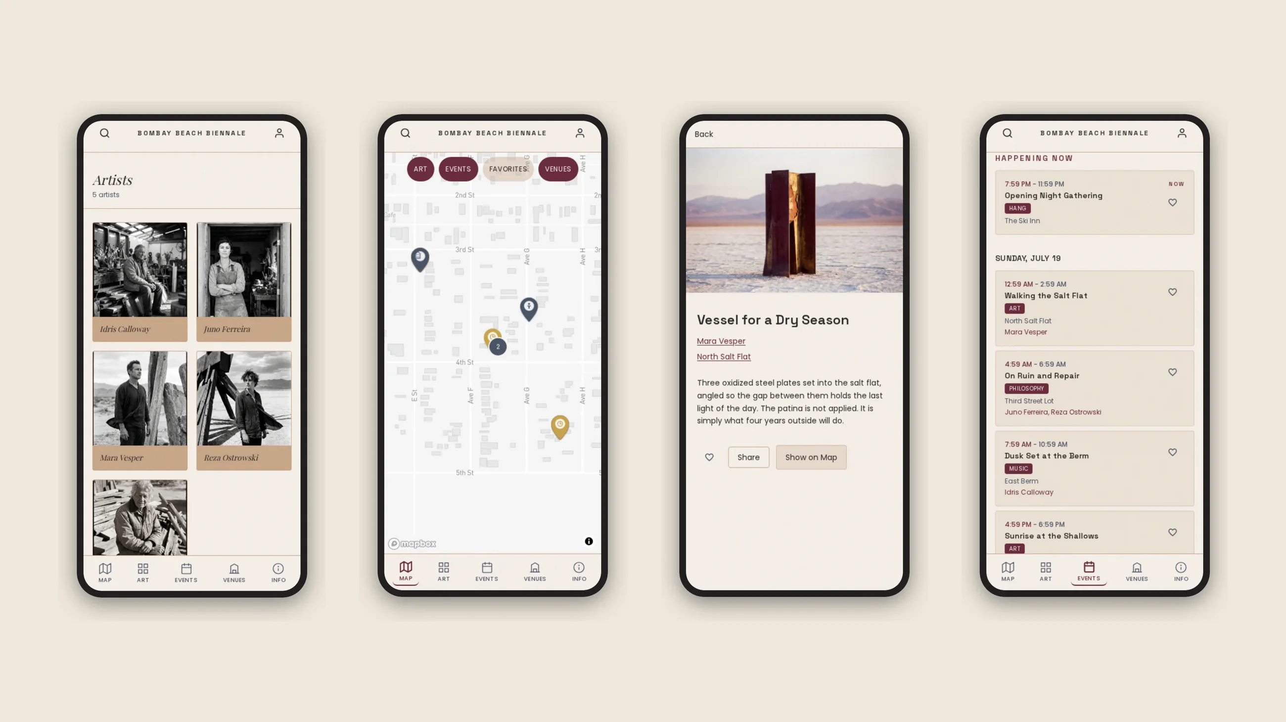
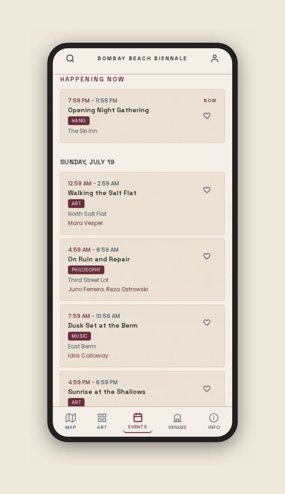
The shipped v2 interface. The artwork and profiles belong to the festival artists, so the screens here use AI-generated stand-ins rather than anyone's real work.
Result
I led the product management across two builds of the official Bombay Beach Biennale progressive web app, shipped on time for the March 26, 2026 event. The platform launched carrying 178 installations and 179 artists, with an SMS plus push broadcast system for real-time event communication and a geo-fenced GPS coordinate system precise enough to direct attendees correctly within the small-town festival environment.
Problem
Bombay Beach Biennale is an annual three-day art festival in Bombay Beach, California, a Salton Sea community with distinctive installation density and an established aesthetic voice. The 2026 event had 179 confirmed artists and 178 installations spread across the town.
The problem was multi-layered. Many installations sit inside abandoned buildings that share property lots with active residences. A simple street address was not specific enough to direct attendees, and undirected attendees disturb townspeople who live in adjacent buildings. The platform had to give artists and organizers a way to pin precise coordinates, not just an address.
Three sharply different user types (attendees, artists, organizers) needed to share the same underlying data in different ways. The festival's visual and writing voice, shaped by Dulcinée DeGuere's publication "Endless Poetry," had to be earned rather than approximated with a generic design. And there was a hard event deadline with no slip option.
My Role
This came in as a client engagement through Fusion Consulting, and it is the one place where product direction was mine end to end rather than the founder's.
v1 (MVP, February 2026, solo with Claude as engineering counterpart). Owned the engagement from initial client conversation through approved PRD. Ran a two-hour discovery session with Dulcinée DeGuere, then researched her writing voice and past Biennale content to derive the design DNA and aesthetic constraints that became the project's guiding document. Authored the design document, specified the data model, defined the three user-type model, directed the implementation, established the GitHub organization and Vercel scope, and shipped the MVP against the event-prep timeline.
Pre-launch user research. Ran research conversations after the MVP was live to surface what needed to change before the event. Findings flowed directly into the v2 brief.
v2 (March 2026 rebuild, co-collaboration with Auston). Led the PM and product side while Auston led the rebuild execution. Drove map provider selection, the SMS blast system decision, the GPS metadata system, the organizer-side content workflow, the photo upload UX redesign, featured card design, social-share image generation, content selection, deployment troubleshooting, and voice-and-tone discipline across the v2 surface.
Research and Insights
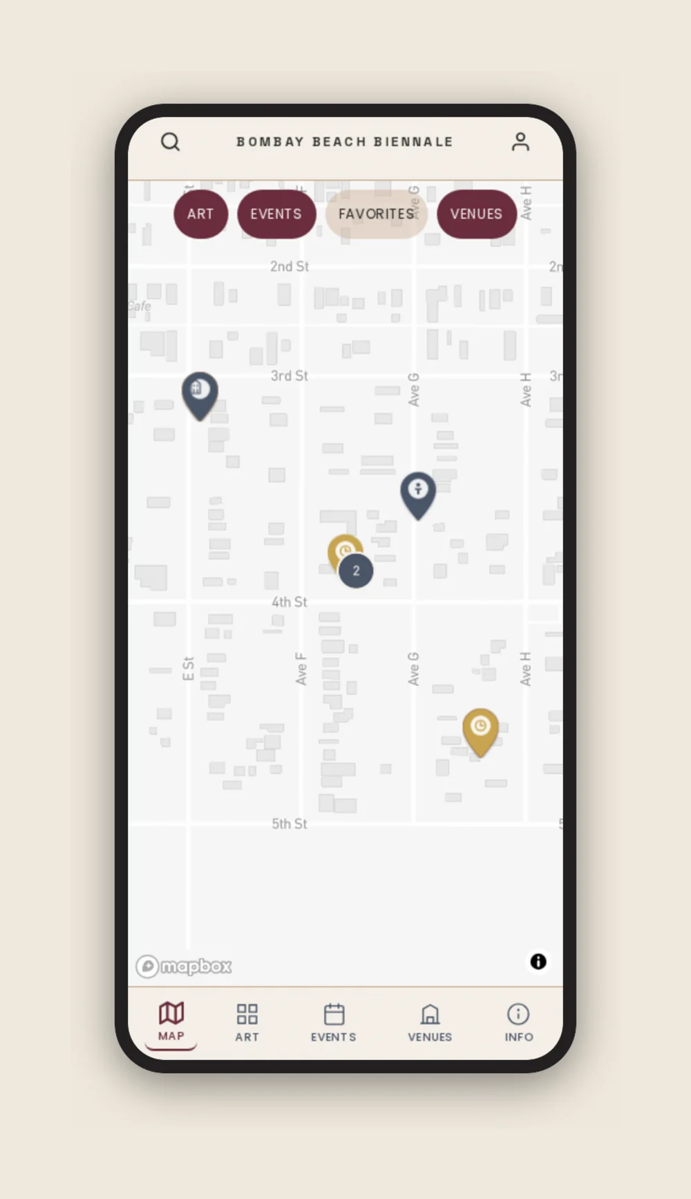
Map provider research and selection. Evaluated map providers against the v2 design DNA and selected Mapbox GL JS over Leaflet (the v1 choice) for its custom-tile styling capability. The v2 PRD records the choice and rationale. The map needed to recede into the brand aesthetic (warm tan, restrained palette) rather than impose the generic blue-and-gray of default OpenStreetMap tiles.
Pre-launch user research with prospective event attendees. Ran research conversations after the MVP to surface UX adjustments and feature requests. The findings drove the v2 brief including the photo upload redesign (v1 forced camera-only capture; v2 allows camera, gallery, or local files).
Solution and Process
v1 approach. Built the design system from the design DNA, specified role-based access (attendees no-login, artists by invite code, organizers via dashboard), and shipped the map, browsing, and artist registration experience.
SMS blast system. Dulcinée asked for emergency-broadcast capability. Rather than build it as a one-off, I scoped it as a durable owned-audience asset. Capturing phone numbers at onboarding means the festival can reach its audience for future events without asking a third-party platform for permission. That is also why v2 moved from no-auth attendees to required auth.
GPS metadata system. Two input paths, map pin-drop and current location, both geo-fenced to Bombay Beach plus three miles, with out-of-bounds coordinates prompting a confirmation rather than a hard rejection. Two paths because a desktop organizer and an artist standing in front of their own installation need different things.
Rejected for GPS. Street addresses alone, because an address cannot distinguish an installation inside an abandoned building from the occupied house sharing the lot.
Referral-tracked share links, because the festival spreads by word of mouth and we needed to see which users actually drove sign-ups.
Impact and Metrics
Shipped publicly across two builds (v1 MVP and v2 rebuild) for the Bombay Beach Biennale 2026 event, carrying 178 installations and 179 artists.
Admin content workflow shipped, with 13 admin pages, 11 API routes, bulk upload, claim flow, artist profile editing, permission and freeze logic.
SMS plus push blast system shipped with phone-number capture at onboarding, establishing a durable owned-audience asset.
Geo-fenced GPS metadata shipped with map-select and current-location capture paths and out-of-bounds confirmation dialog.
Pre-launch user research directly fed v2 UX iteration on photo upload and map UI.
Reflection
I would lock content commitments from the organizer side earlier in the v2 production calendar. The platform shipped on time with the admin workflow in place, but the manual content load that bridged v1 and v2 carried over more than it had to, particularly on GPS coordinate identification where some installations needed cross-referencing across multiple sources. A stricter content-readiness gate mid-build, with explicit organizer ownership of the harder fields (GPS, photos) and platform-side fallback handling for partial-content cases, would have reduced the manual lift at launch.
Start a conversation
Want to work together?
I'm looking for my next product management role. I've led as the only product person, and I've worked inside larger teams, and I'm glad to do either. What matters to me is shipping things that count, with people I can learn from.